See Jobsite Photos on an Interactive Map
Turn scattered site photos into a clear, location-based view — so you always know exactly where every job happened.

Trusted by Teams Across Industries


Key Feature: Map-Based Jobsite Photo Visualization

See Every Photo at Its Exact Location
• Map Your Photos: Every photo is pinned to the map automatically using its GPS data, so locations are easy to track.
• Quick Location Insights: See where work happened, compare locations, and spot missing coverage — without opening photos one by one.
• Perfect for Large Sites: Ideal for sprawling job sites, multi-location projects, and route-based work.
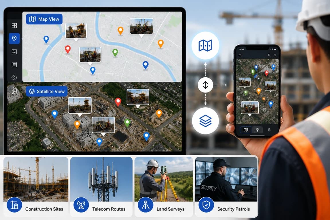
Toggle Between Map and Satellite Views
• Flexible Views: Pick the view that fits your workflow for effortless photo navigation.
• Map View: A clean, distraction-free layout to scan every jobsite location, compare positions, and spot gaps at a glance.
• Satellite View: See real-world surroundings, structures, and terrain for full context.
• Ideal for Field Work: Great for construction sites, telecom routes, land surveys, and security patrols.
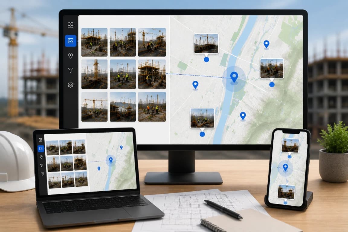
Find the Right Photo Faster with Location Labels
• Precise Location Selection: Zoom in and click the exact spot on the map — no guessing filenames or endless scrolling.
• Split-Screen View: See all photos on the left and their exact map locations on the right, on one screen.
• Quick Photo Search: Find the photos you need straight from the map, without scrolling or searching endlessly.
• Show or Hide Terrain: Toggle terrain on the map for either a clean or a detailed view.
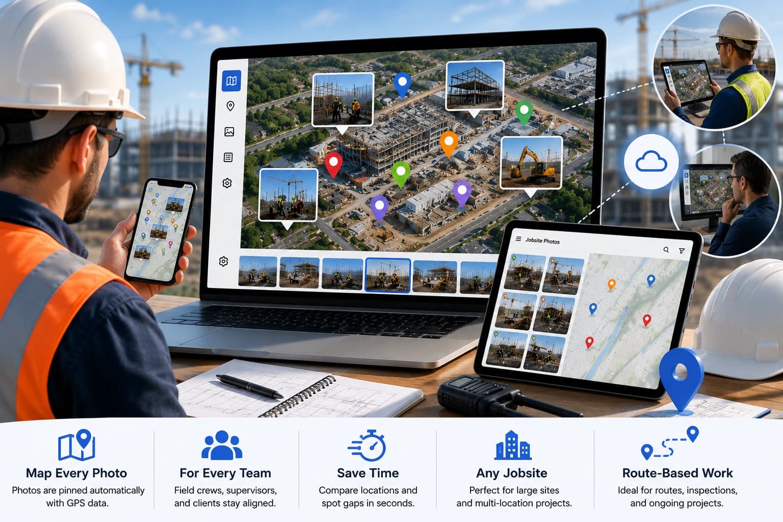
Made for Real Field Crews
A Map-Based View for Real Fieldwork
Photo Map plots every jobsite photo on an interactive map using its GPS data, so location is never a guess. Crews, supervisors, and clients can see exactly where each shot was taken.
Before Photo Map, teams cross-checked filenames and notes to work out where a job happened. With Photo Map, you scan a single map, compare locations, and spot missing coverage in seconds — perfect for large sites, multi-location projects, and route-based work.