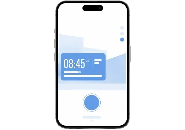
The Best GPS Camera for Geotagging Photos
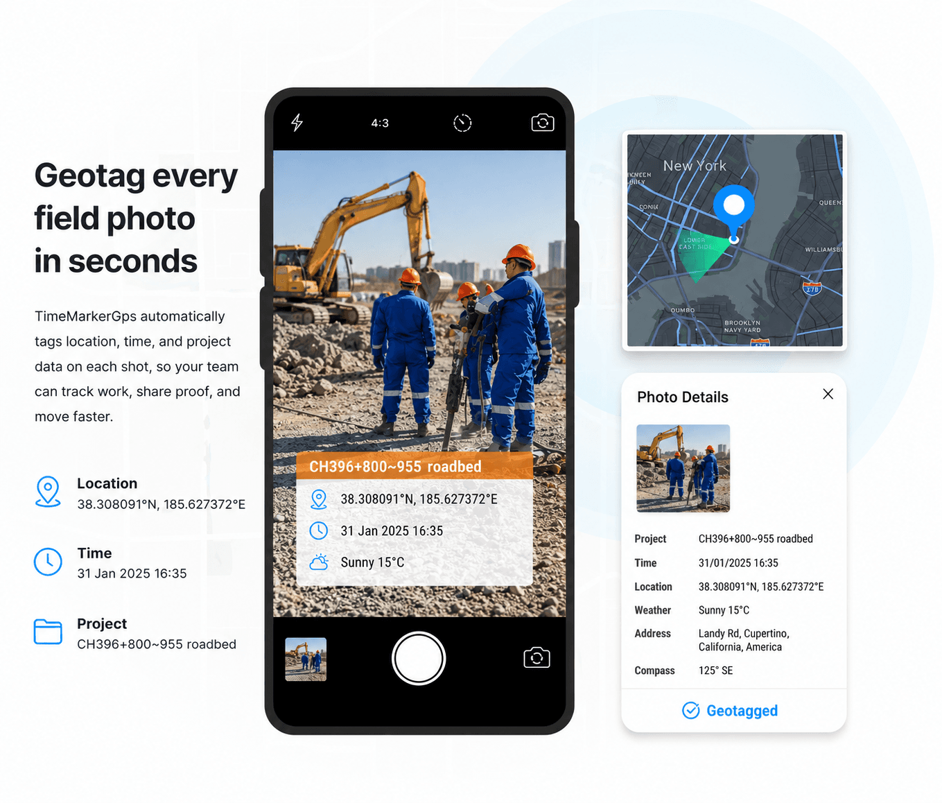
Geotag every field photo in seconds with the best GPS camera. TimeMarkerGps automatically tags location, time, and project data on each shot, so your team can track work, share proof, and move faster.
The Future of Intelligent Field Tracking.
Trusted by global teams to streamline operations and enhance workforce accountability. Elevate your performance with TimeMarkerGPS.


How to Find a Photo's GPS Location?
1. Get TimeMarkerGps App
Search for TimeMarkerGps in your app store and install it. Open the app and allow camera and location access.
2. Take Geotagged Photos
Open the TimeMarkerGps camera and snap your field photo. It adds the GPS location and timestamp automatically.
3. Share Photos
Share or export your photos in a tap. Each photo's GPS location travels with it, so your team can confirm exactly where it was taken.
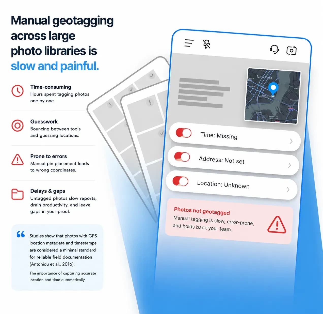
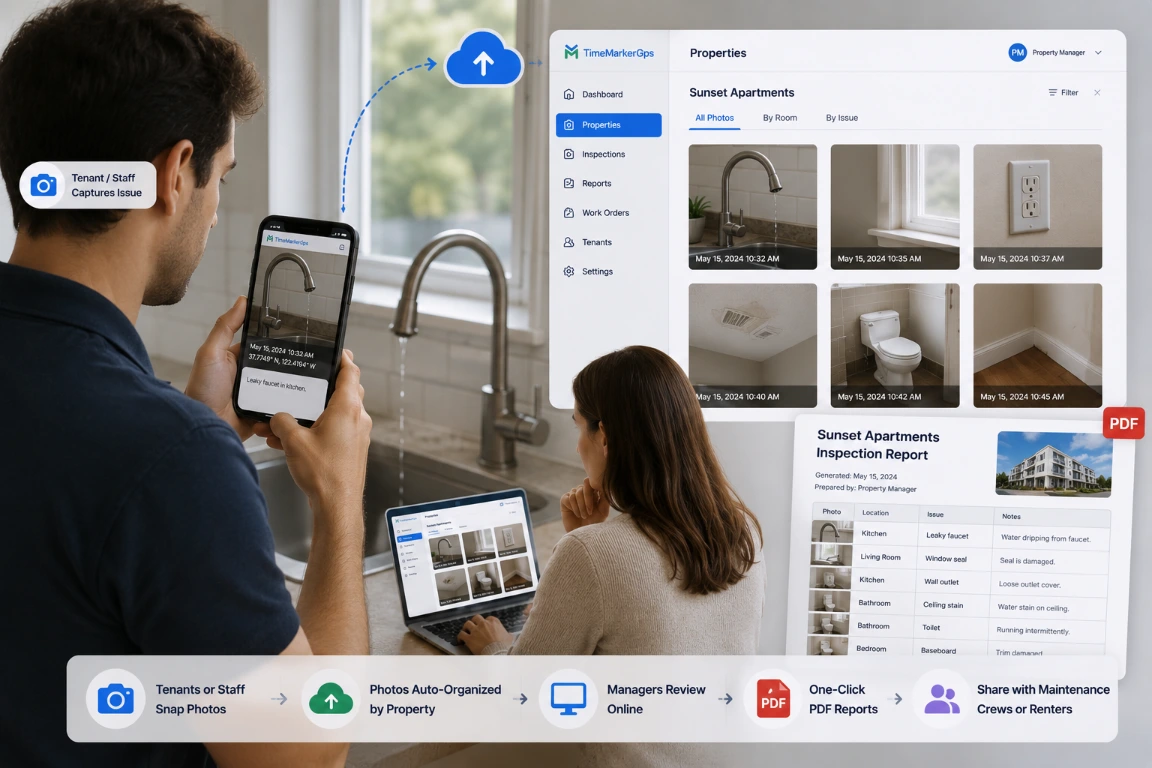
Manual Geotagging Is Eating Your Time
Manual geotagging across large photo libraries is slow and painful. You bounce between tools, guess at locations, and correct wrong coordinates by hand. Untagged photos hold up client reports, drain productivity, and leave gaps in your work proof. Studies show that photos with GPS location metadata and timestamps are considered a minimal standard for reliable field documentation (Antoniou et al., 2016), highlighting the importance of capturing accurate location and time automatically.
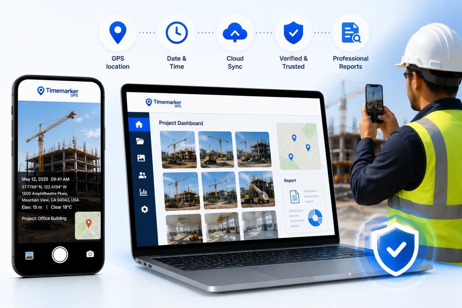
TimeMarkerGps fixes this by automatically stamping every photo with GPS coordinates and capture time, then organizing project shots for fast, verifiable reporting. Teams capture and manage all field photos with full location and time context, cutting errors and strengthening accountability.
Standout Features
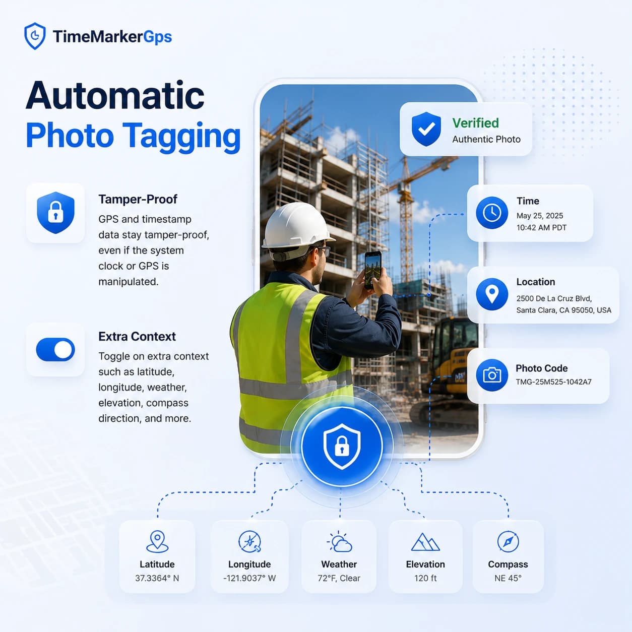
Stamp Geotags & Timestamps Automatically
Get dependable proof of when and where work happened on every shot. The TimeMarkerGps timestamp camera automatically tags each photo with GPS data, date, time, and coordinates, delivering trustworthy visual evidence for any inspection or report.
- GPS and timestamp data stay tamper-proof, even if system time or GPS is manipulated
- Switch on extra context such as latitude, longitude, weather, elevation, compass direction, and more
- Built-in verification through a unique photo code keeps every record authentic and traceable
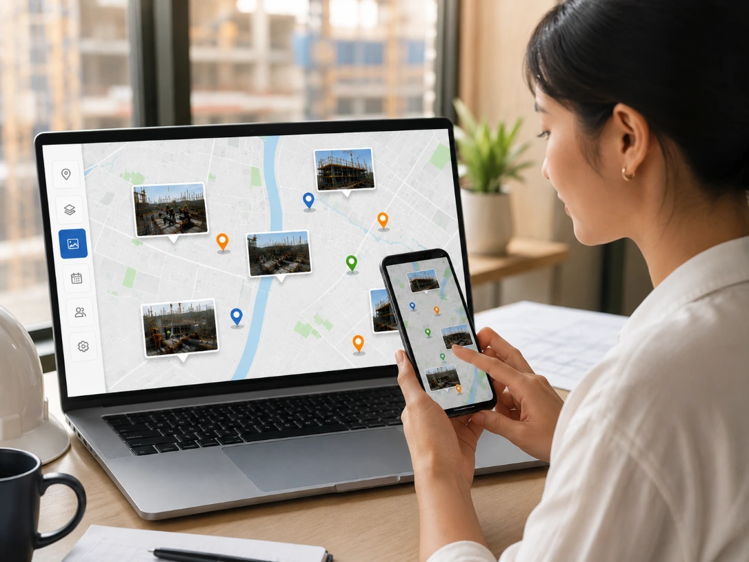
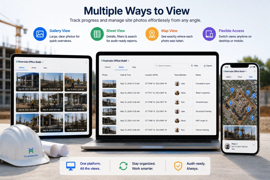
Built-In Map Overlay & Map View
Add a compact map overlay that automatically shows where each photo was taken. The map view in the web portal lets your team visualize field progress and confirm project locations with precision.
- Turn on the map field to pin the exact capture location on every photo
- Follow project progress on a clear, easy-to-read map layout
- Zoom in to inspect specific areas or zoom out to see the whole site at a glance
Add Your Company Logo
Bring professional polish to every proof. TimeMarkerGps lets you stamp your company logo on each photo or video, turning field documentation into branded, verifiable evidence.
- Add a logo by uploading, searching within the app, or creating one with art text
- Refine logos with tools like the background remover and opacity control
- Apply your logo straight onto client-ready reports
Where Teams Put It to Work
Construction Pros
The GPS camera by TimeMarkerGps verifies change orders and proves work completion. Back every photo with location data, your strongest defense against disputes.
Fiber Optics Contractors
Document splice pits, handholes, pull‑boxes, and duct runs with map‑view tracking and location‑based metadata, giving clients a transparent visual record of work as it happens.
Land surveying
Record precise location and timestamp data plus detailed metadata such as compass and elevation to build reliable, complete documentation. Export photos as KMZ files for seamless integration with mapping software.
TimeMarkerGps vs Other Photo Tools
Comparison | TimeMarkerGps's Advantages |
vs System Camera | TimeMarkerGps keeps GPS location even when sharing photos. System camera loses location, so you’d have to add them back manually. |
vs GPS Map Camera | Unlike other GPS camera solutions, TimeMarkerGps locks real GPS and timestamp data to prevent tampering. While GPS Map Camera also lacks centralized storage and team sync, TimeMarkerGps securely stores all photos in one place for real-time access. It also offers multiple viewing modes, including gallery and sheet views. |
vs CompanyCam | TimeMarkerGps locks time and location to keep proof of work reliable, and lets you add or generate professional logos easily. CompanyCam allows edits and offers fewer logo options. |
vs Drone | While drones are useful for capturing wide aerial views, TimeMarkerGps is the best GPS camera system for accurate, ground-level documentation. It provides real GPS and timestamp data and automatic cloud backup for team access. Compared to the high cost and maintenance of drones, TimeMarkerGps is a far more cost-effective solution. |
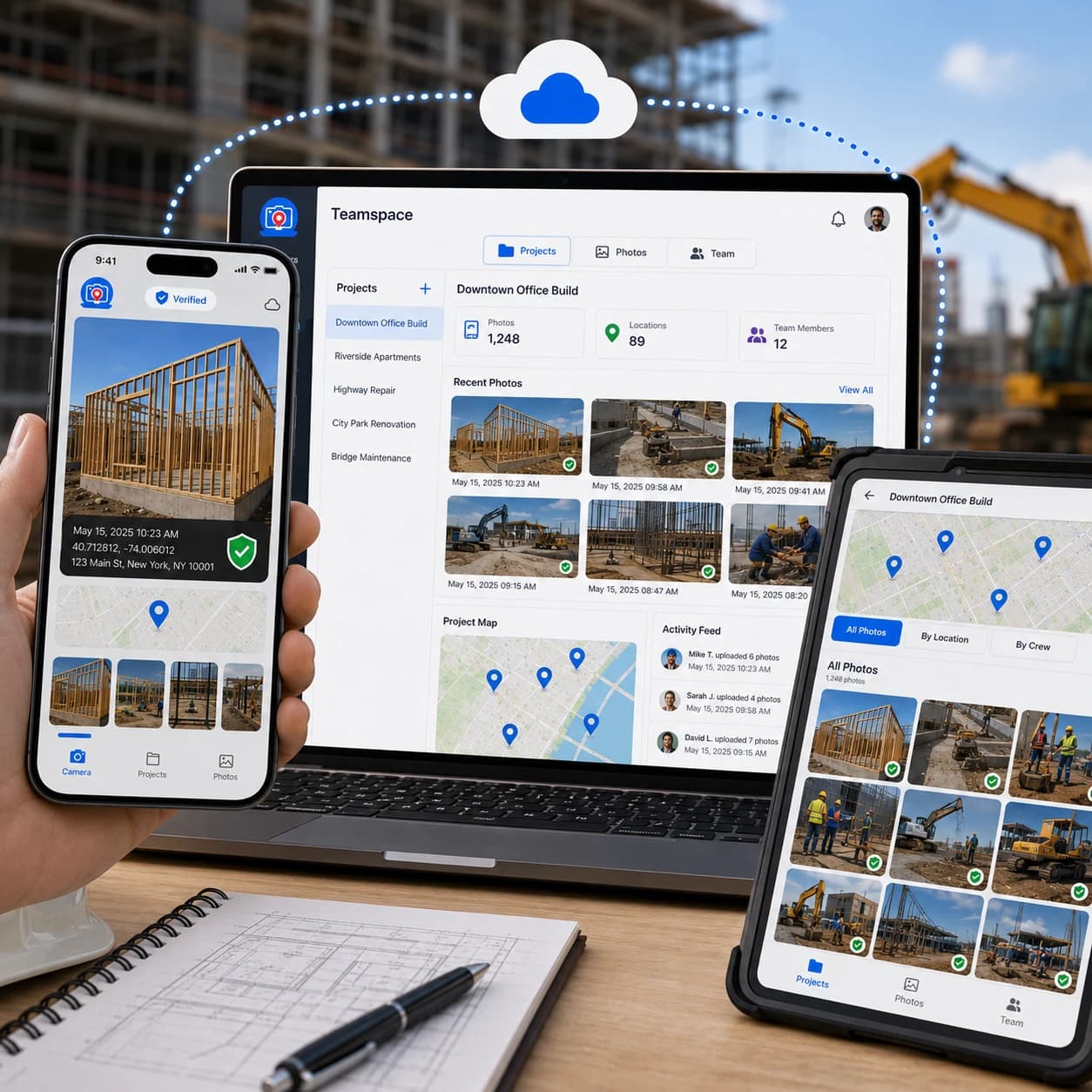
Ready to Organize Job Photos Smarter?
The TimeMarkerGps GPS camera captures geotagged photos, and Teamspace takes it further. Auto-organize all your job photos by project or team member, with no manual sorting ever. Open Teamspace now and turn your GPS shots into a tidy, easy-to-share workflow.
|
|
|
|
|
"I'm a construction contractor, and TimeMarkerGps changed how we handle field photos. I used to spend two hours every night sorting my team's photos and trying to remember which shot belonged to which project. Now TimeMarkerGps auto-adds GPS stamps and organizes everything by project and member. It's the best GPS camera app I've ever used!"
|
|
|
|
|
"As a telecom contractor, we're always on different job sites, and tracking photos used to be a nightmare. My team would send shots by text or email, and half the time the location notes went missing. With TimeMarkerGps, every photo carries a GPS stamp and timestamp."
|
|
|
|
|
"Our team covers 20+ sites a day, and TimeMarkerGps keeps us organized. Every inspection photo carries the exact time and place, and even new hires pick it up in five minutes. It's reliable, simple, and the only tool we need to prove we did the work right."
Questions Field Teams Ask Most
Try the Best GPS Camera for Free!
Download TimeMarkerGps free to auto-geotag and auto-sort your field photos, capture solid work proof, and protect your business income.